


Similar products
Similar products


$100 min
Wholesale Jersey, New-York, Connecticut, and Rhode Island: of Aquanishuonîgy, the Country of the Confederate Indians; Comprehending Aquanishuonîgy Proper, Their Place of Residence, Ohio and Tïiuxsoxrúntie Their Deer-hunting Countries; Couxsaxráge and Skani...
WSP
$59.95 MSRP
Shipping & policies
- Estimated delivery Jan 20-28
Free and easy returns. Learn more
With Faire, shop unique wholesale products for your store from brands like Relic Map Co. and more.
Description
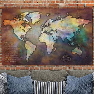
Old map of America, Northeastern States, United States. Created by Robert Dodsley, Lewis Evans, James Turner in 1755. * Scale ca. 1:2,250,000. * Cover title: Middle British colonies in America: Original wrappers. * Hand colored, coloration does not agree with legend. * Relief shown pictorially. * Shows "Longitude west of London" and "from Philadelphia." * "Sold by R. Dodsley in Pall-Mall, London." * Includes text, distance charts, historical notes, and inset of "A sketch of the remaining parts of Ohio R. &c." * Accompanied by: An analysis of a general map of the middle British colonies in America; ... 32 p.
Details
SKU: 34045_75693767_20.3x27 Made in United States Weight: 99.79 g (3.52 oz)


