


Similar products
Similar products


Shipping & policies
- Estimated delivery May 11
Free and easy returns. Learn more
With Faire, shop unique wholesale products for your store from brands like Finke and more.
Description
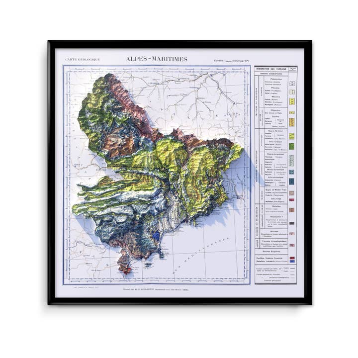
Reproduction of an old map on the geology of the Alpes-Maritimes (Provence-Alpes-Côte-d'Azur) drawn by C. Pellegrin, civil engineer of Mines and printed by Imbert in Grasse. It depicts the edge of the Mediterranean Sea with the cities of Nice, Antibes, Cannes, Grasse, as well as the mountainous massif of the Pre-Alps and the valleys of the Var or the Roya. * Poster printed on Fine Arts Hahnemuehle 315g paper. * Size: 60x60 cm * This poster is a 2D print.
This info has been automatically translated. Show Original Language
Details
SKU: geo-003 Made in France Weight: 100 g (3.53 oz) EAN: 3760414670844


