


Similar products
Similar products


$100 min
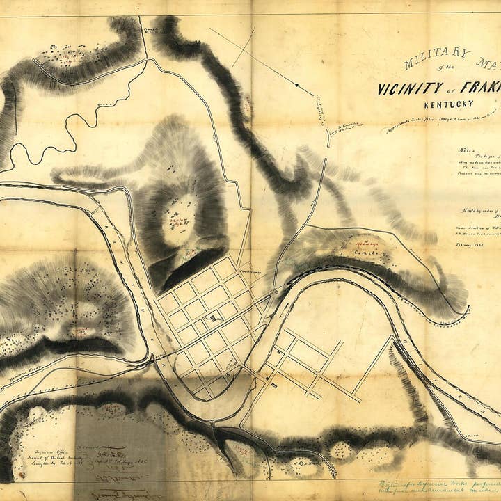
Wholesale Military Map of the Vicinity of Frankfort, Kentucky 1863
WSP
$166.95 MSRP
Shipping & policies
- Estimated delivery Jan 12-21
Free and easy returns. Learn more
With Faire, shop unique wholesale products for your store from brands like Relic Map Co. and more.
Description
Old manuscript map of Frankfort, Kentucky, United States. Created by J. H. Brooks, O. M. (Orlando Metcalfe) Poe in 1863. * Shows streets, rivers and creeks, locations of the arsenal and "U.S. Hd. Qrs.," and recommended defensive positions. * Annotated in blue pencil : Positions for defensive works proferred [sic] by Col. Gilbert with force and armament marked blue. * Relief shown by hachures and spot heights. * Annotated in ink: A correct copy, [signed] T.B. Brooks, Capt. N.Y. Vol. Engrs. A.D.C., Engineers Office, District of Central Kentucky, Lexington, Ky., Feb. 18, 1863. Also annotated on verso: Vicinity of Frankfort. T.B. Brooks, 1862, No. 26. * Pen and ink. * Civil War Map Map Subjects Civil War Fortification Frankfort Frankfort (Ky.) History Kentucky Manuscript Maps Maps Manuscript United States J. H. Brooks O. M. (Orlando Metcalfe) Poe 1863
Details
SKU: 16636_86691123_29.4x40.7 Made in United States Weight: 99.79 g (3.52 oz)


