


Similar products
Similar products


$100 min
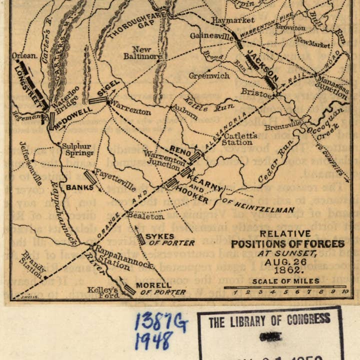
Wholesale Relative Positions of Forces at Sunset, Aug. 26, 1862. 2nd Manassas Campaign 1886
WSP
$29.95 MSRP
Shipping & policies
- Estimated delivery Jan 12-21
Free and easy returns. Learn more
With Faire, shop unique wholesale products for your store from brands like Relic Map Co. and more.
Description
Old map of Manassas Region, United States, Virginia. Created by Jacob Wells in 1886. * Scale ca. 1:520,000. * Civil War Map * From Century illustrated monthly magazine, v. 31, Jan. 1886. p. 446. * Map extends from White Plains south to Kelley's Ford, and from Orlean east to Manassas Junction. * Description derived from published bibliography.
Details
SKU: 27138_99439197_4.9x3.7 Made in United States Weight: 99.79 g (3.52 oz)


