


Similar products
Similar products


€86.84 min
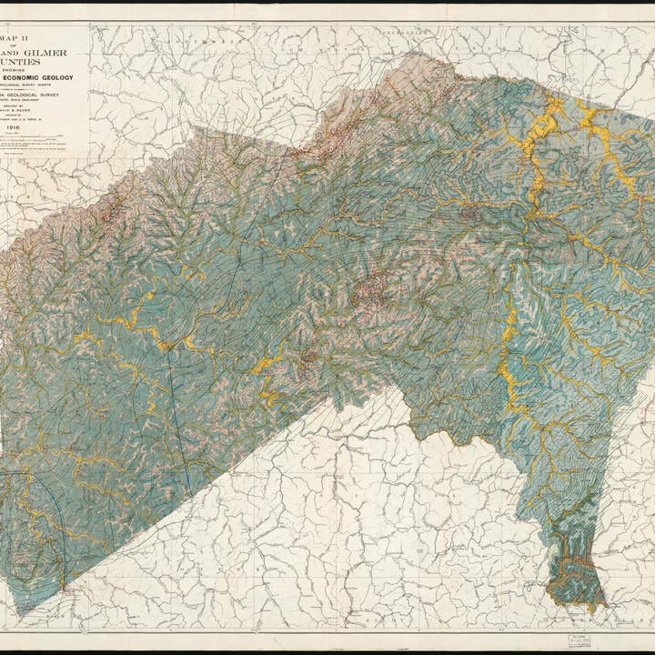
Wholesale Map II of Lewis and Gilmer Counties Showing General and Economic Geology (Lewis and Gilmer Counties Showing General and Economic Geology) 1916
Wholesale Map II of Lewis and Gilmer Counties Showing General and Economic Geology (Lewis and Gilmer Counties Showing General and Economic Geology) 1916
Wholesale Map II of Lewis and Gilmer Counties Showing General and Economic Geology (Lewis and Gilmer Counties Showing General and Economic Geology) 1916
Wholesale Map II of Lewis and Gilmer Counties Showing General and Economic Geology (Lewis and Gilmer Counties Showing General and Economic Geology) 1916
WSP
€147.95 MSRP
Shipping & policies
- Estimated delivery Nov 24-Dec 3
Free and easy returns. Learn more
With Faire, shop unique wholesale products for your store from brands like Relic Map Co. and more.
Description
Old map of Gilmer County, Lewis County, United States, West Virginia. Created by David B. (David Bright) Reger, West Virginia Geological and Economic Survey, I. C. (Israel Charles) White in 1916. * Relief shown by contours and spot heights. * "Base: U.S. Geological Survey sheets."
Details
SKU: 32461_96687028_36.3x46.3 Made in United States Weight: 99.79 g (3.52 oz)


