


Similar products
Similar products


$152.99 min
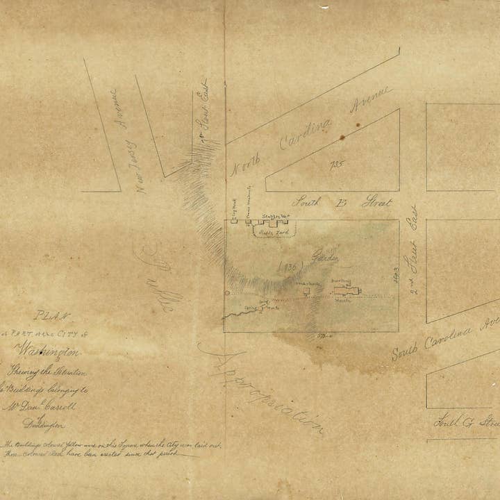
Wholesale Plan of Part of the City of Washington Shewing the Situation of the Buildings Belonging to Mr. Dan'l Carroll of Duddington 1796
Wholesale Plan of Part of the City of Washington Shewing the Situation of the Buildings Belonging to Mr. Dan'l Carroll of Duddington 1796
Wholesale Plan of Part of the City of Washington Shewing the Situation of the Buildings Belonging to Mr. Dan'l Carroll of Duddington 1796
Wholesale Plan of Part of the City of Washington Shewing the Situation of the Buildings Belonging to Mr. Dan'l Carroll of Duddington 1796
WSP
$83.00 MSRP
Shipping & policies
- Estimated delivery on Nov 14–25
Free and easy returns. Learn more
With Faire, shop unique wholesale products for your store from brands like Relic Map Co. and more.
Description
Old map of Capitol Hill, District of Columbia, United States, Washington, Washington D.C.. Created by N. (Nicholas) King in 1796. * Covers area bounded by 1st and 2nd streets and North and South Carolina avenues S.E., Capitol Hill, Washington D.C. * Relief shown by hachures. * Shows block numbers and outlines, dimensions, buildings, and function of buildings. * Pen-and-ink and watercolors on tracing linen. * Traced by Dr. Joseph M. Toner from the original map by Nicholas King ca. 1796. * Has circular cameo impression: [Profile of head with] Toner Library. * Accompanied by ms. tracing (lead-pencil and watercolors on tracing paper) of the original King map: Plan of part of the city .
Details
SKU: 20970_91683161_16.3x19.4 Made in United States Weight: 99.79 g (3.52 oz)


